
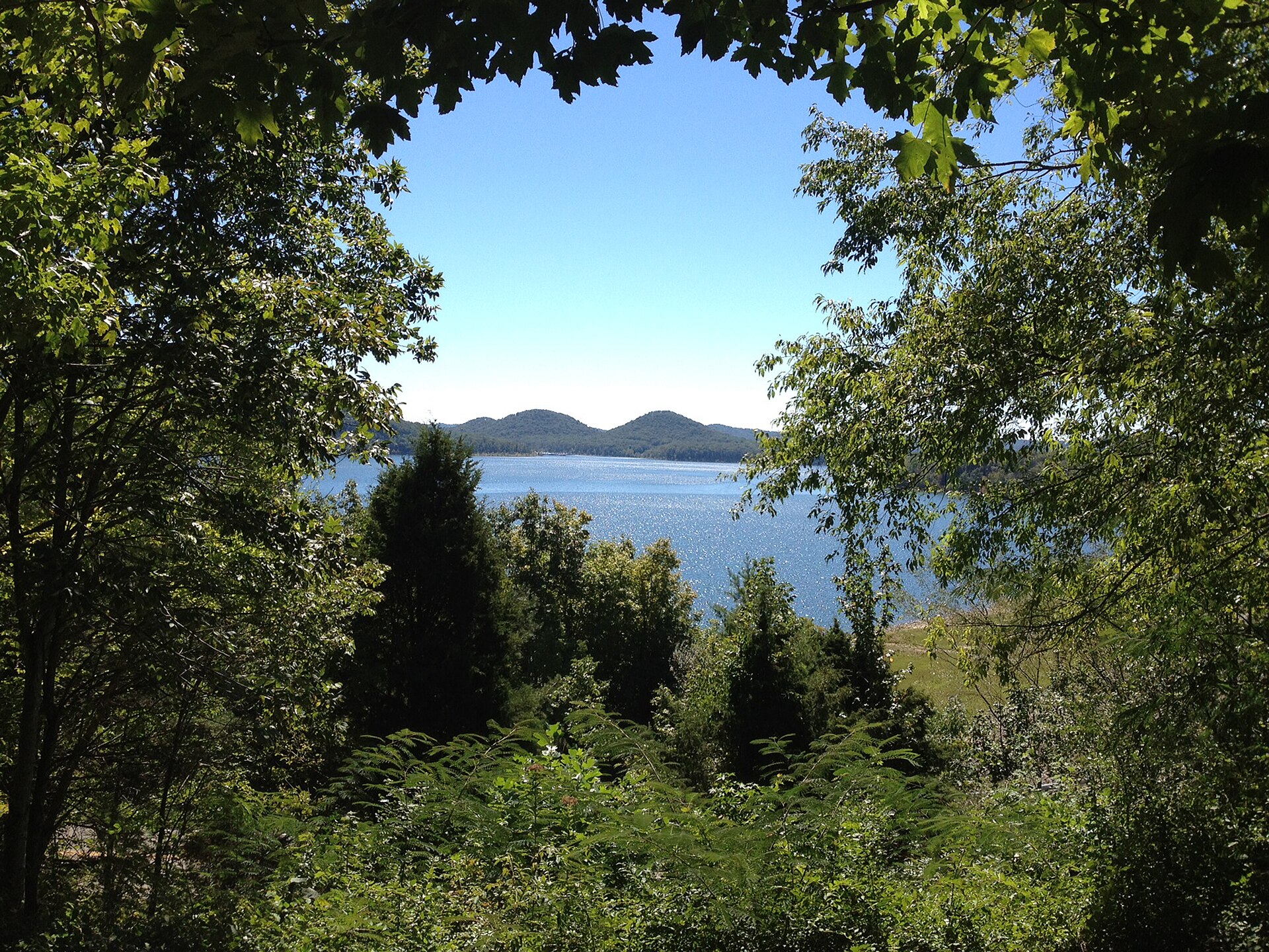
8,270 acres of Licking River backed up behind a 148-foot dam, almost completely surrounded by the Daniel Boone National Forest, with the state-record muskellunge on the books and a 40-inch minimum to keep the next one in the water. This is the state’s muskie lake: stocked every year, and the hatchery that grows the fish sits below the dam on KY 801.
The lake in one paragraph
Cave Run Lake is an Army Corps impoundment on the Licking River in north-eastern Kentucky, authorised under the Flood Control Act of 1938, started in 1965 and finished in 1974. The dam is earth and rock fill, 148 feet tall and half a mile long, with a concrete control tower on the upstream face, two large hydraulically controlled main gates and two smaller valve-controlled bypass pipes. It exists for flood risk reduction, water supply, fish and wildlife, and recreation. The lake backs into Rowan, Bath, Menifee and Morgan counties. What makes it different from every other Corps lake on this site is the land: on completion the Corps handed most of what it had bought to the Forest Service, so the lake and shoreline are run by the Cumberland Ranger District of the Daniel Boone National Forest, and the Corps keeps the dam and its own day-use areas — the tailwater, the damsite, High Bank and Stoney Cove. That split decides which rulebook applies where you are standing, and it comes up again below.
The pool year, and the gauge that actually reads it
The Louisville District publishes the schedule. Summer pool is 730.0 feet, winter pool 724.0, both NGVD29. The fill runs 16 March to 1 May. The drawdown is in two stages, and the second one is the one that matters.
| Window | From | To | What it is |
|---|---|---|---|
| 16 Mar – 1 May | 724.0 | 730.0 | Spring fill to summer pool |
| 1 May – 15 Sep | 730.0 | Summer pool | |
| 15 Sep – 14 Oct | 730.0 | 729.5 | Drawdown stage 1 — half a foot |
| 15 Oct – 1 Dec | 729.5 | 724.0 | Drawdown stage 2 — the other five and a half |
| 1 Dec – 16 Mar | 724.0 | Winter pool | |
Those are targets. This is a flood-control lake, and it sits above target after rain for as long as the Corps needs to hold water back. The record is 761.12 feet, crested on 20 April 2015 — 31 feet over summer pool, and just under four feet below the 765-foot spillway. The previous record was 759.7 on 5 May 2011. The Forest Service closes the Zilpo beach and ramp when the lake goes over 740. So the published schedule tells you what the Corps is aiming at; the gauge tells you where the water is.
What six feet does here
The half-foot step between 15 September and 14 October is close to nothing on the water; it is the Corps easing off the top. The move that rearranges the lake is 15 October to 1 December, when five and a half feet come out in six weeks. Two things about it are documented rather than guessed.
First, KDFWR’s access records carry winter-pool warnings on five launches, in its own words: Warix Run “cannot be used at winter pool”; Beaver Creek “cannot launch at winter pool”; Blackwater is “difficult to launch during winter pool”; Ramey Creek, the carry-down, is “difficult to launch at winter pool”; and Ramp 26 is “4WD advised, may be difficult to launch” in any season. Two gone, two marginal, one you should not trust a two-wheel-drive truck on.
Second, KDFWR wrote in October 2019 that “the best fishing, once the lake level has reached winter pool, is on the lower end of the lake by the dam.” That is the agency’s statement, dated, and we quote it as such rather than as this season’s report.
Seventeen launches, and which ones stop working
KDFWR lists fifteen trailered ramps on the lake, two carry-down launches, and six bank sites. All of them are below, with KDFWR’s directions verbatim and the launch notes in the agency’s words. The tailwater ramp below the dam is a separate KDFWR record and launches onto the Licking River, not the lake; it is in the table because it is a no-fee launch and it is the ramp for the trout water.
| Launch | County | Getting there (KDFWR) | What is there |
|---|---|---|---|
| Stoney Cove | Bath | I-64 E of Owingsville; KY-801 (Exit 133) south; right on KY 826; cross dam and make first left | Paved single lane, no fee, 51+ paved parking, no dock, seasonal restrooms, year-round. Corps area with dump station and picnic area. |
| Scotts Creek | Rowan | I-64 W of Morehead; KY 801 S (Exit 133) | Paved multi-lane, fee, 26–50 paved parking, courtesy dock, seasonal restrooms, marina year-round limited hours, accessible ramp. Year-round. |
| Twin Knobs | Rowan | I-64 W of Morehead; KY 801 S (Exit 133); right at Twin Knobs Campground | Paved multi-lane, fee, courtesy dock, seasonal. “Ramp available only to paid campers.” |
| Alfrey | Rowan | I-64 W of Morehead; KY 801 S (Exit 133); right at Twin Knobs Campground; first blacktop on left | Paved multi-lane, fee, 51+ paved parking, courtesy dock, seasonal restrooms and camping, accessible ramp. Year-round. |
| Ramey Creek · carry-down | Rowan | I-64 W of Morehead; KY 801 S (Exit 133); across causeway over Ramey Creek, left on gravel, down grade to site | Carry-down only, no fee, unpaved parking ≤25, no facilities. “Difficult to launch at winter pool.” |
| Warix Run | Rowan | I-64 W of Morehead; KY 801 S (Exit 133); follow signs past Ramey Creek | Paved multi-lane, light trailerable boats, fee, courtesy dock, seasonal restrooms. “Launch cannot be used at winter pool.” |
| Zilpo | Bath | I-64 E of Owingsville; US 60 E (Exit 123); KY 211 S; left on Clear Creek Road; left on Tater Knob Tower/Zilpo Road | Paved multi-lane, light trailerable boats, fee, courtesy dock, seasonal camping and restrooms, retail. Forest Service: ramp is camper-exclusive and closes with the beach above 740 ft. |
| Clay Lick | Rowan | I-64 W of Morehead; KY 801 S (Exit 133); Hwy 1274 S; Hwy 3138 W | Paved multi-lane, light trailerable boats, fee, courtesy dock, seasonal restrooms, walk-in / boat-in camping year-round. Year-round. |
| Bangor | Rowan | I-64 W of Morehead; KY 801 S (Exit 133); Hwy 1274 SE; left on New Hope Road at Bangor | Paved single lane, light trailerable boats, fee, unpaved parking, courtesy dock, seasonal restrooms, no accessible facilities. Year-round. |
| Poppin Rock | Rowan | KY 519 S of Morehead near Morgan County line | Paved multi-lane, light trailerable boats, fee, 51+ paved parking, courtesy dock, seasonal restrooms, retail. Year-round. |
| Blackwater | Morgan | KY 7 N of West Liberty; left on Hwy 519; left on KY 976 | Paved single lane, no fee, unpaved parking ≤25, no dock, no restrooms. “Small fishing boats only; difficult to launch during winter pool.” |
| Ramp 26 | Morgan | KY 7 N of West Liberty; left on Hwy 519; left on Hwy 772; right after crossing bridge over lake | Paved multi-lane, fee, unpaved parking ≤25, no dock. “4WD advised, may be difficult to launch.” |
| Leatherwood | Menifee | KY 36 NE of Frenchburg; right on Hwy 211; right on Clear Creek Road to Leatherwood Road | Paved multi-lane, light trailerable boats, fee, unpaved parking, courtesy dock, seasonal restrooms. Year-round. |
| Skidmore · carry-down | Menifee | KY 36 E of Frenchburg; Hwy 1274 E; left on Skidmore Creek Road; follow to lake | Carry-down only, no fee, unpaved parking ≤25, no facilities. Year-round. |
| Longbow | Menifee | KY 36 NE of Frenchburg; Hwy 1274 E; ramp on left | Paved multi-lane, fee, unpaved parking, courtesy dock, seasonal restrooms, marina year-round limited hours, picnic area. Year-round. |
| Beaver Creek | Menifee | KY 36 E of Frenchburg; Hwy 1274 E; ramp on right side between Scranton and Longbow Marina | Paved single lane, no fee, paved parking, no dock, no restrooms, seasonal. “Cannot launch at winter pool.” |
| Tailwater · below the dam | Bath | I-64 E of Owingsville; KY 801 S (Exit 133); right on KY 826; first road to right after crossing dam | Paved single lane, light trailerable boats, no fee, paved parking ≤25, seasonal restrooms, year-round. Launches onto the Licking River, not the lake. |
Bank access. KDFWR lists six bank sites, all no fee: High Bank (first road on the right past KY 826 off KY 801; Corps picnic area), Boat Gunnel (first right past Scotts Creek Marina; year-round, limited hours), Shallow Flats (turn at the goose enclosure; “handicapped fishing access available”), Musky Bend and Lake View (both past Twin Knobs Campground on the right), and North Fork (KY 519 south of Morehead, left on Paragon-Craney Road; public fishing along the road, camping year-round).
Ramps and the published low-water figures
Seventeen launches, every ramp and carry-down KDFWR lists on the lake and the one below the dam, in the order of the table above, against what the agencies publish about each one and the water. The short answer for this lake: no agency we could read publishes a minimum elevation for any ramp on Cave Run Lake. The Corps’ water-management record carries the pool, not ramp elevations; the Louisville District’s own lake page would not load for us on 2 November 2026; the Corps Lakes Gateway names Stoney Cove, the damsite, the tailwater and High Bank with open-or-closed icons and no elevation; Recreation.gov’s Twin Knobs and Zilpo campground pages each mention a boat ramp and no water level; and the National Weather Service’s gauge record for Licking River at Cave Run Lake (CRLK2, the same site as USGS 03249498), which at Taylorsville Lake names the elevation at which the water is below two ramps, carries no impact statements at all for this lake. What is published is in two agencies’ words. KDFWR’s access records carry launch notes on five launches, quoted in their rows: Warix Run “cannot be used at winter pool”, Beaver Creek “cannot launch at winter pool”, Blackwater and the Ramey Creek carry-down are “difficult to launch” at it, and Ramp 26 is “4WD advised, may be difficult to launch” with no season attached. Winter pool is 724 feet on the Louisville District’s schedule, but KDFWR ties those notes to the pool stage, not to a ramp elevation, so we do not turn them into a number to compare a reading with. The Daniel Boone National Forest publishes a page for nine of the launches, and every one carries a high-water line, not a low-water one: the ramp or site “will become unsafe and/or inaccessible if lake levels rise above” 733 feet at Twin Knobs, 734 at Clay Lick, 735 at Alfrey, Blackwater and Scotts Creek, 736 at Bangor and Longbow, 742 at Beaver Creek, and Zilpo’s beach and ramp “will close if lake levels rise above 740 feet”. Those lines are quoted in their rows with each page’s last-updated date and are never compared; the Forest Service does not say which datum they are on, and each page links a lake gauge for the current level. The Forest Service’s Beaver Creek page adds “You cannot launch during winter pool”, the same thing KDFWR says. One dated change: the Forest Service’s Scott Creek Boat Ramp page, updated 15 October 2026, says “Ramp will be closed November 16, 2026 through January 2027 to facilitate dock replacement at Scott Creek Marina.” We found no Forest Service page for Poppin Rock, Leatherwood, Warix Run, Ramp 26, Skidmore or Ramey Creek; Stoney Cove and the tailwater ramp are Corps areas with no published figure, and the tailwater ramp launches onto the Licking River, so the lake reading under this table does not describe its water. Where there is nothing, the row says so. The reading, when there is one, is the USGS gauge’s, feet above NGVD 1929. As of 2 November 2026 this lake’s row on the site’s levels feed is switched off, so the line under the table reads “No current reading” until it is turned on; read the gauge yourself meanwhile. What a dock tells you by phone is current in a way this table is not.
| Ramp (access road) | Published low-water figure or note | Source (date read) |
|---|---|---|
| Stoney Cove I-64 E of Owingsville; KY-801 (Exit 133) south; right on KY 826; cross dam and make first left | Not published - check with the dock | KDFWR access record 45, read 2 Nov 2026; Corps Lakes Gateway, Cave Run Lake, read 2 Nov 2026 |
| Scotts Creek Ramp I-64 W of Morehead; KY 801 S (Exit 133) | No low-water figure or note published. The Forest Service’s Scott Creek Boat Ramp page (last updated 15 October 2026) says: “Ramp will be closed November 16, 2026 through January 2027 to facilitate dock replacement at Scott Creek Marina.” High water, the same page: “This site will become unsafe and/or inaccessible if lake levels rise above 735 feet.” KDFWR’s record carries no water-level note. | Daniel Boone National Forest, Scott Creek Boat Ramp, read 2 Nov 2026; KDFWR access record 526, read 2 Nov 2026 |
| Twin Knobs Ramp I-64 W of Morehead; KY 801 S (Exit 133); right at Twin Knobs Campground | No low-water figure or note published. KDFWR’s record: “ramp available only to paid campers.” The Forest Service’s Twin Knobs Campground page (last updated 16 March 2026): “The boat ramp is for the exclusive use of Twin Knobs campers.” High water, the same page: “The boat ramp will become unsafe and/or inaccessible if lake levels rise above 733 feet.” | KDFWR access record 527, read 2 Nov 2026; Daniel Boone National Forest, Twin Knobs Campground, read 2 Nov 2026 |
| Alfrey Boat Ramp I-64 W of Morehead; KY 801 S (Exit 133); right at Twin Knobs Campground; first blacktop on left | No low-water figure or note published. High water: the Forest Service’s Alfrey Boat Ramp page (last updated 20 May 2025) says “This site will become unsafe and/or inaccessible if lake levels rise above 735 feet.” KDFWR’s record carries no water-level note. | KDFWR access record 528, read 2 Nov 2026; Daniel Boone National Forest, Alfrey Boat Ramp, read 2 Nov 2026 |
| Ramey Creek (carry-down) I-64 W of Morehead; KY 801 S (Exit 133); across causeway over Ramey Creek, left on gravel, down grade to site | KDFWR access record: “difficult to launch at winter pool”. Winter pool is 724 feet on the Louisville District’s schedule; KDFWR publishes no elevation for the launch itself. | KDFWR access record 529, read 2 Nov 2026 |
| Warix Run Ramp I-64 W of Morehead; KY 801 S (Exit 133); follow signs past Ramey Creek | KDFWR access record: “Launch cannot be used at winter pool”. Winter pool is 724 feet on the Louisville District’s schedule; KDFWR publishes no elevation for the ramp itself. | KDFWR access record 530, read 2 Nov 2026 |
| Zilpo I-64 E of Owingsville; US 60 E (Exit 123); KY 211 S; left on Clear Creek Road; left on Tater Knob Tower/Zilpo Road | No low-water figure or note published. The Forest Service’s Zilpo Campground page (last updated 7 April 2026): “The boat ramp is for the exclusive use of Zilpo campers.” High water, the same page: “The beach and boat ramp will close if lake levels rise above 740 feet.” KDFWR’s record carries no water-level note. | KDFWR access record 44, read 2 Nov 2026; Daniel Boone National Forest, Zilpo Campground, read 2 Nov 2026 |
| Clay Lick Ramp I-64 W of Morehead; KY 801 S (Exit 133); Hwy 1274 S; Hwy 3138 W | No low-water figure or note published. High water: the Forest Service’s Claylick Boat Ramp page (last updated 31 August 2026) says “This site will become unsafe and/or inaccessible if lake levels rise above 734 feet.” KDFWR’s record carries no water-level note. | KDFWR access record 531, read 2 Nov 2026; Daniel Boone National Forest, Claylick Boat Ramp, read 2 Nov 2026 |
| Bangor Boat Ramp I-64 W of Morehead; KY 801 S (Exit 133); Hwy 1274 SE; left on New Hope Road at Bangor | No low-water figure or note published. High water: the Forest Service’s Bangor Boat Ramp page (last updated 16 June 2026) says “This site will become unsafe and/or inaccessible if lake levels rise above 736 feet.” KDFWR’s record carries no water-level note. | KDFWR access record 532, read 2 Nov 2026; Daniel Boone National Forest, Bangor Boat Ramp, read 2 Nov 2026 |
| Poppin Rock Boat Ramp KY 519 S of Morehead near Morgan County line | Not published - check with the dock | KDFWR access record 533, read 2 Nov 2026 |
| Blackwater Ramp KY 7 N of West Liberty; left on Hwy 519; left on KY 976 | KDFWR access record: “small fishing boats only; difficult to launch during winter pool”. Winter pool is 724 feet on the Louisville District’s schedule. High water: the Forest Service’s Blackwater Boat Ramp page (last updated 31 August 2026) says “This site will become unsafe and/or inaccessible if lake levels rise above 735 feet.” Neither agency publishes an elevation for the ramp itself. | KDFWR access record 451, read 2 Nov 2026; Daniel Boone National Forest, Blackwater Boat Ramp, read 2 Nov 2026 |
| Ramp 26 KY 7 N of West Liberty; left on Hwy 519; left on Hwy 772; right after crossing bridge over lake | No low-water figure published. KDFWR access record: “4WD advised, may be difficult to launch.” The record ties that note to no water level or season. | KDFWR access record 452, read 2 Nov 2026 |
| Leatherwood Ramp KY 36 NE of Frenchburg; right on Hwy 211; right on Clear Creek Road to Leatherwood Road | Not published - check with the dock | KDFWR access record 429, read 2 Nov 2026 |
| Skidmore (carry-down) KY 36 E of Frenchburg; Hwy 1274 E; left on Skidmore Creek Road; follow to lake | Not published - check with the dock | KDFWR access record 432, read 2 Nov 2026 |
| Longbow Ramp KY 36 NE of Frenchburg; Hwy 1274 E; ramp on left | No low-water figure or note published. High water: the Forest Service’s Longbow Boat Ramp page (last updated 31 August 2026) says “This site will become unsafe and/or inaccessible if lake levels rise above 736 feet.” KDFWR’s record carries no water-level note. | KDFWR access record 430, read 2 Nov 2026; Daniel Boone National Forest, Longbow Boat Ramp, read 2 Nov 2026 |
| Beaver Creek Ramp KY 36 E of Frenchburg; Hwy 1274 E; ramp on right side between Scranton and Longbow Marina | KDFWR access record: “cannot launch at winter pool”. The Forest Service’s Beaver Creek Boat Ramp page (last updated 20 May 2025) says the same: “You cannot launch during winter pool.” Winter pool is 724 feet on the Louisville District’s schedule. High water, the same Forest Service page: “This site will become unsafe and/or inaccessible if lake levels rise above 742 feet.” Neither agency publishes an elevation for the ramp itself. | KDFWR access record 431, read 2 Nov 2026; Daniel Boone National Forest, Beaver Creek Boat Ramp, read 2 Nov 2026 |
| Cave Run Lake tailwater (below the dam) I-64 E of Owingsville; KY 801 S (Exit 133); right on KY 826; first road to right after crossing dam | Not published - check with the dock | KDFWR access record 33, read 2 Nov 2026; NWS gauge record FRMK2, Licking River at Farmers, read 2 Nov 2026 |
Latest reading against these figures: not loaded. The comparison fills in from this site’s levels feed when the page’s script runs; with scripts off, read the pool yourself at USGS 03249498, Cave Run Lake near Farmers (lake elevation, parameter 62614, NGVD 1929) and set it against the figures and notes above.
No current reading on this site’s levels feed for Cave Run Lake. Read the pool yourself at USGS 03249498, Cave Run Lake near Farmers (lake elevation, parameter 62614, NGVD 1929); the figures and notes in the table still stand.
Lake level: , read at (USGS 03249498, Cave Run Lake near Farmers (lake elevation, parameter 62614, NGVD 1929), provisional).
Last reported ; the source is running behind. Check it before you drive.
Email alerts for Cave Run Lake · the time shown is the reading’s own; nothing older than three days is shown; a reading is compared only with a figure an agency has published, and nothing here says whether a ramp can be used.
Basis: 17 launches listed; 0 with a published minimum elevation; 12 with a published agency note on launching or water level. Every figure and note is the agency’s own wording, and each row names its source and the day it was read. A ramp with no published figure or note says so; nothing is estimated. The reading, when one appears, comes from this site’s levels feed (/api/levels) with its own time.
What the regulations tell you about the lake
Cave Run’s bass rules changed on 3 September 2026. The regulation, 301 KAR 1:201, Section 3(14), now reads as below, and the 2026–27 Kentucky Fishing & Boating Guide (“Updated September 2026”) prints the same rules. KDFWR’s waterbody record for the lake has not caught up: on 5 October 2026 it still listed the retired 12–15 inch largemouth slot and a 6-bass limit. Where the two differ, the regulation is the law.
| Species | The rule, verbatim |
|---|---|
| Black bass | “Black bass aggregate daily limit, ten (10).” The Guide: black bass “includes largemouth, smallmouth and Kentucky (spotted) bass” — “10 fish daily limit on black bass singly or combined.” |
| Largemouth bass | “No more than five (5) fish in a daily limit shall be twelve (12) inches or longer.” The Guide: “only 5 of the 10 can be 12” or above.” |
| Smallmouth bass | “Smallmouth bass size limit, eighteen (18) inches.” |
| Spotted bass | No Cave Run rule of its own; counts toward the ten. Statewide, Section 2(1)(a)2: “Kentucky bass and Coosa bass, no size limit.” |
| Muskellunge | “Muskellunge size limit, forty (40) inches.” |
| Crappie, white bass | No Cave Run rule; statewide limits apply. |
| Additional | The Guide: “Gigging and snagging prohibited in lake and all tributaries up to the first riffle or upper boundary”. |
The muskellunge creel is the statewide one, Section 2(1)(d): “Muskellunge daily limit, one (1)”. KDFWR’s 2026 Fishing Forecast restates it as “40-inch minimum size, one fish daily limit.” Read together: 40 inches, one fish. The forecast also restates the smallmouth rule as an 18-inch minimum.
Read the table as a description of the lake. A 40-inch minimum on muskellunge is what a state puts on the water it wants its trophy fish to come from. The largemouth rule is the one that changed: until September Cave Run carried the 12–15 inch protective slot that Elkhorn Creek still carries, and the regulation replaced it with a ten-bass limit in which no more than five largemouth may be 12 inches or longer. Neither the regulation nor the Guide says why. KDFWR’s 2026 Fishing Forecast, written under the old slot, says fish under eight inches dominate the population and that harvesting them will help it. An 18-inch smallmouth minimum, well above statewide, says the state would rather you photographed them.
The Forest Service rules that reach the bank
Because the shoreline is national forest, three Forest Service orders apply here that do not exist on Taylorsville or Rough River. The wording below is the agency’s.
- “Fishing from any boat ramp or courtesy dock” is prohibited. That is the whole lake, every ramp, every dock, under the General Lake Prohibitions order in force since 24 February 2015 with no end date.
- Camping within 300 feet of the water’s edge, or within 300 feet of any road or trail leading to it, is prohibited except at designated sites. Same order. So is leaving a watercraft unattended overnight anywhere not designated for it, and launching a motor boat anywhere not designated for launching.
- The KY 801 corridor is closed to hunting and shooting. A separate order, in force since 11 May 2015, prohibits hunting and discharging a firearm on National Forest land “between Kentucky Highway 801 South and Cave Run Lake from the Fern Bluff recreation area to Warix Run Boat Ramp, including the waters of Scott Creek Bay (east of the idle speed buoy line between Scott Creek Boat Ramp and Twin Knobs Boat Ramp).” A third order, also from February 2015, extends the hunting and firearm prohibition to the Shallow Flats Wildlife Viewing Area and bars camping within 300 feet of Forest Road 918 in the Pioneer Weapons WMA outside designated sites.
The south shore is something else again. Pioneer Weapons Wildlife Management Area is 7,731 acres of Forest Service land in Bath and Menifee counties, roughly ten miles south of Morehead, and the Zilpo and Leatherwood ramps sit inside it. Hunting there is “limited to longbow, crossbow and muzzle-loading firearms only” — no breech-loaders, no in-line muzzleloaders, iron sights only. It is a primitive-weapons deer area, and a fall angler launching at Zilpo or Leatherwood is standing in it. That is not a closure; it is context for the parking lot in November. There is no KDFWR-managed “Cave Run Lake WMA” — the public land here is national forest.
What KDFWR’s 2026 forecast says
The Fishing Forecast is a dated document, so these are quoted as the agency’s 2026 statements, not as this week’s report.
- Muskellunge: “Trophy fish exist and can be found primarily in the spawning month of April in the backs of the large coves and Beaver Creek or in the fall months of September and October in association with gentle sloping gravely banks or near channel drop offs.”
- Smallmouth bass: “Fewer in numbers but excellent-size fish are in the lake. Found primarily off rocky points or shoreline in the lower lake.”
- Spotted bass: “Smaller in size and most numerous within the middle and lower main lake shoreline; become less common within the upper reaches of the lake.”
- Largemouth bass: “Good numbers of fish over 15 inches in the lake, but still high number of fish less than 8 inches that dominate the overall population.”
- White bass: “Fantastic population with the potential for widespread jumps in the summer months.”
- Crappie: “Several recent good spawns should continue to bring this population back and fish are in the ideal size range for harvesting.”
- Catfish: “Good numbers of Channel Catfish up to two feet long are common along with a few larger sizes.”
- Sunfish: “Widespread and common, but most are 7 inches long or less.”
Muskellunge are stocked annually — KDFWR’s species page lists Cave Run with Green River, Dewey and Buckhorn — and the Minor E. Clark Fish Hatchery below the dam, one of the largest state-owned warm-water hatcheries in the country, produces them among three to four million fingerlings a year. The state record, 54 inches and 47 pounds, came out of Cave Run in November 2008. No KDFWR page we read gives a Cave Run stocking number, so we do not print one.
Where the state has put cover
KDFWR publishes a Google My Maps layer and a GPX file of marked fish-attractor sites for Cave Run Lake, from the agency’s attractor index — Cave_Run_Lake.gpx. We have not been able to open and count the file, and KDFWR does not state a count on the page, so unlike Taylorsville there is no number here. Take the file from them.
What we have not verified
- Current pool. Live. Read USGS 03249498, parameter 62614, not any number printed on a website, including this one.
- Ramp and area closures. Live. The Corps Lakes Gateway showed High Bank Picnic Area closed on 9 September 2026 and again on 2 November 2026, and the Forest Service closes Zilpo above 740 feet. The Forest Service’s Scott Creek Boat Ramp page, read 2 November 2026, says the ramp “will be closed November 16, 2026 through January 2027” for dock replacement; whether it closes and reopens on those dates is the agency’s to say. We print the rules and the dated notices, not the status.
- Algal bloom status. Kentucky publishes advisories only through the Division of Water’s interactive HAB viewer, which cannot be read from a static page. Check it directly in summer.
- Shoreline miles, maximum depth, storage. No Corps, Forest Service or KDFWR page we read states a figure. Status pending.
- Master plan. The current plan dates from 1984 and the Corps says an update is in progress. No dated document was readable. Status pending.
- Tailwater trout stocking. KDFWR’s September 2026 monthly stocking page shows no Cave Run tailwater entry. Whether the tailwater is stocked at all this year is unconfirmed.
- Attractor count and muskellunge stocking numbers. Not published on any page we read.
- The Fill and Drawdown page itself. It carries a July 2024 decommissioning banner and was still live on 9 September 2026. If it goes, the 730/724 figures need a new primary citation, and the water watch re-checks it every run.
Upcoming tournaments on this water
Filed or published by the organisers; each row is the organiser’s own wording, read on the date shown, and a closed or youth event still tells you when the ramp will be busy. Confirm the date, the ramp and the entry with the organiser before you go. The full calendar is at Tournaments.
- 7 Nov 2026Dink Nation ClassicDink Nation Bass ClubStoney Cove · 8:00 AM to 4:00 PMBlack bass · Closed TournamentEntry fee: not stated (read 28 Oct 2026)Organiser’s details as published, read 28 Oct 2026 · Organiser’s KDFWR filing
- 7 Nov 2026Renegade Fall Division 6 Cave RunRenegade Bass TournamentsCave Run Lake, Alfrey (as printed by the organiser) · Safe Light to 3:00 PMSpecies not stated · Renegade fall division event; format not statedEntry fee: not stated (read 28 Oct 2026)Organiser’s details as published, read 28 Oct 2026 · Organiser’s page
- 10 Apr 2027MCHS Regional Qualifier #7Montgomery County High School Bass Fishing TeamStoney Cove · 7:00 AM to 3:00 PMBlack bass · Open Tournament; high schoolEntry fee: not stated (read 28 Oct 2026)Organiser’s details as published, read 28 Oct 2026 · Organiser’s KDFWR filing
- 17 Apr 2027MCHS Regional Qualifier #8Montgomery County High School Bass Fishing TeamStoney Cove · 7:00 AM to 3:00 PMBlack bass · Open Tournament; high schoolEntry fee: not stated (read 28 Oct 2026)Organiser’s details as published, read 28 Oct 2026 · Organiser’s KDFWR filing
- 24 Apr 2027KHSAA Region 4 RegionalSAF (Student Angler Federation)Stoney Cove · 7:00 AM to 3:00 PMBlack bass · Closed Tournament; KHSAA high school region tournamentEntry fee: not stated (read 28 Oct 2026)Organiser’s details as published, read 28 Oct 2026 · Organiser’s KDFWR filing
- 24 Apr 2027KHSAA RegionalMajor League Fishing (filed for the KHSAA event)Stoney Cove · 6:30 AM to 3:00 PMBlack bass · Open Tournament (as filed); KHSAA high school bass fishingEntry fee: not stated (read 28 Oct 2026)Organiser’s details as published, read 28 Oct 2026 · Organiser’s KDFWR filing
Sources and how confident we are
Check it yourself
- USGS 03249498 — Cave Run Lake near Farmers (use parameter 62614)
- USGS 03249500 — Licking River at Farmers (tailwater discharge)
- USACE Louisville District — Fill and Drawdown
- Corps Lakes Gateway — Cave Run Lake (area status)
- 301 KAR 1:201 (the regulation; Cave Run is Section 3(14))
- KDFWR — Kentucky Fishing & Boating Guide (PDF) (Cave Run on printed page 8)
- KDFWR — Cave Run Lake waterbody record (access list; its regulations table predates the September 2026 amendment)
- Daniel Boone National Forest — Cave Run Lake
- Forest Service — General Lake Prohibitions
- KDFWR — monthly trout stocking
- Kentucky Division of Water — HAB viewer
Sources: U.S. Army Corps of Engineers, Louisville District — Cave Run Lake page, Master Plan Update page, Fill and Drawdown page, Water Information page and the “Cave Run Lake sets new record pool” release, for the dam, purposes, acreage, pool schedule, datum and record pool; Great Lakes and Ohio River Division recreation page and the Corps Lakes Gateway for the project office and Corps-run areas. Kentucky Department of Fish and Wildlife Resources — waterbody records 137 and 335, the 23 access-site records, the 2026 Fishing Forecast, the Muskellunge species page, the 2 October 2019 fall-muskie article, the Pioneer Weapons WMA public lands record and the fish attractor index. USGS NWIS for gauges 03249498 and 03249500. U.S. Forest Service, Daniel Boone National Forest — Cave Run Lake, campground, marina and visitor centre pages and the three standing orders. For the ramps table (2 November 2026): KDFWR access records 45, 526, 527, 528, 529, 530, 44, 531, 532, 533, 451, 452, 429, 432, 430, 431 and 33; Daniel Boone National Forest pages for the Alfrey, Bangor, Beaver Creek, Blackwater, Claylick, Longbow and Scott Creek boat ramps and the Twin Knobs and Zilpo campgrounds; the Corps’ water-management record for Cave Run Lake; the Corps Lakes Gateway; the National Weather Service gauge records CRLK2 and FRMK2. Verify current conditions before travelling.